SWIM Project’s Latest Mars Ice Map to Aid Future Human Missions

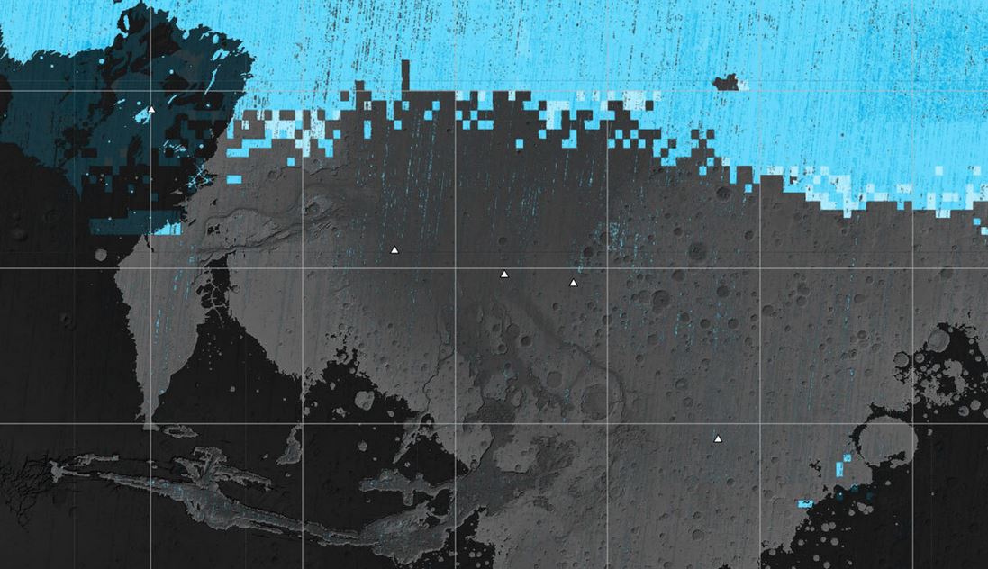
NASA’s SWIM project releases a map of subsurface ice on Mars to assist in selecting landing sites for future human missions, aiming to balance proximity to this vital resource with reasonable temperatures. (Photo: nasa.gov)
NASA’s SWIM Project Reveals New Mars Ice Map for Future Human Missions
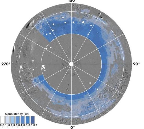
According to source, the NASA-funded Subsurface Water Ice Mapping (SWIM) project has unveiled its fourth map detailing the likely locations of subsurface ice on Mars. This map is aimed at aiding mission planners in selecting landing sites for future human missions to the planet. SWIM, led by the Planetary Science Institute and managed by NASA’s Jet Propulsion Laboratory, has been accumulating data from various Mars missions since 2017 to create this ice on Mars map.
The latest ice on Mars map incorporates data from the Context Camera (CTX) and High-Resolution Imaging Experiment (HIRISE), both aboard the Mars Reconnaissance Orbiter.
These instruments provide high-resolution images of Martian terrain, helping identify regions likely to contain subsurface ice, including areas with polygon terrain created by seasonal ice melting and refreezing.
READ ALSO: Astronomers Unlock Mysteries of the Planet Uranus with First-Ever Infrared Aurora Detection
Unlocking Mars’ Ice Secrets: Vital Insights for Crewed Missions and Planetary Mysteries
Identifying the presence of Martian ice is critical for planning crewed missions. Astronauts require access to ice on Mars for drinking and as a resource, reducing the need to transport water from Earth. The landing site selection must strike a balance between proximity to ice on Mars and reasonable temperatures, as extremely cold regions would require extra energy for heating. Therefore, planners aim for landing zones as close to the Martian equator as possible while ensuring the presence of accessible ice on Mars.
Beyond mission planning, these ice on Mars maps could contribute to a deeper understanding of Mars’ geological features and why variations in ice concentrations exist across the Martian mid-latitudes. The maps may lead to new hypotheses about these disparities and help scientists unravel the planet’s mysteries related to ice on Mars.


